A Google Maps glitch directed drivers to go the wrong way up a street in Toronto’s Oakwood Village neighbourhood last week, prompting the city to request a meeting with the tech company to see what can be done to ensure that does not happen again.
The street in question is Winona Drive, which runs one-way southbound past Belvidere Avenue. The affected stretch of road is located north of Vaughan Road and east of Oakwood Avenue.
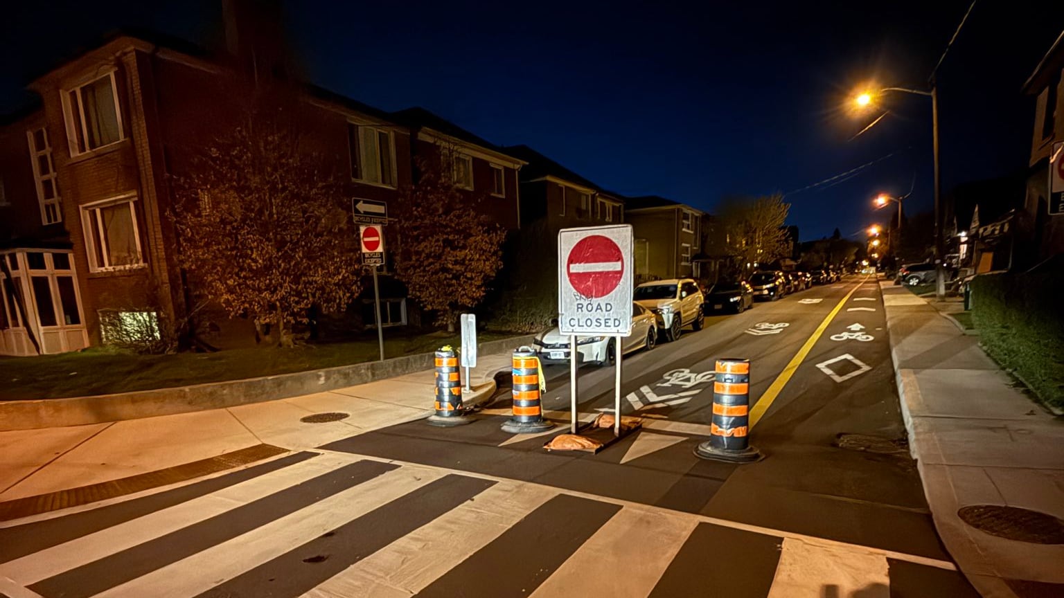
‘Bizarre’ situation
Local Coun. Josh Matlow says his office was advised of the “bizarre” situation last Wednesday.
“We immediately escalated the complaint to the city’s Transportation Services division, who contacted Google Maps to rectify the error,” he wrote in a May 4 post on X.
“Upon request, the city also installed a temporary ‘Do Not Enter’ sign to prevent cars from continuing north along Winona Dr. to Eglinton.”
Matlow said the Google Maps error was corrected early Monday morning and traffic has returned to normal.
Fix took time, city says
Kelsey Carriere, a senior project manager with the City of Toronto’s Transportation Services, said they work closely with Google Maps and communicate directly with their team when any issues arise.
“However, fixes do not happen instantaneously,” she said in a written statement provided to CP24.
“By Friday evening when we realized the issue wasn’t resolved, Transportation Services added large temporary Do Not Enter signage to the northbound Winona Drive and Belvedere Avenue intersection to stop vehicles from proceeding the wrong way.”
Carriere added that the division would continue to work with Google Maps to “understand how such an error occurs to avoid a scenario like this in the future.”
Google says it takes ‘driver safety very seriously’
In a statement provided to CP24 on Thursday, Google said it takes “driver safety very seriously” and has rectified the routing error on Winona Drive.
In an article on its website, the company said it uses AI to understand traffic conditions and determine routes as well as “predict what traffic will look like in the near future.”
Historical traffic patterns for roads are also analyzed over time, Google said in the piece.
Authoritative data from local governments and real-time feedback from users is also considered in this process.
“To keep Maps updated, we use multiple sources including information from local authorities, third-party data providers, and feedback from our community,” a spokesperson wrote in an email.
“We are always open to collaborating with trusted data sources to provide the most reliable information for drivers.”
Google added that all drivers are encouraged to remain vigilant and pay close attention to local road signs and their surroundings while using navigation apps.

City, Matlow want meeting with Google Maps
The city said both Matlow and Transportation Services have followed up with Google Maps to request a meeting to better understand what happened and discuss what improvements can be made to prevent errors like that from occurring in the future.
“These sorts of Google glitches cause real and immediate safety impacts on our streets,” the Toronto—St. Paul’s representative said.
“Google Maps needs to be far more responsive to residents’ complaints, and far more transparent about the processes in place.”

