Toronto

Severe thunderstorm watch issued for Toronto as heavy rain, strong winds hit GTA

Updated: 

Published: 

A person looks out over Lake Ontario as a thunderstorm rolls through in Toronto on Thursday, August 4, 2022. THE CANADIAN PRESS/Nathan Denette

Toronto could see 60 millimetres of rainfall on Wednesday as thunderstorms and strong winds roll into the region, according to an advisory from Environment Canada.

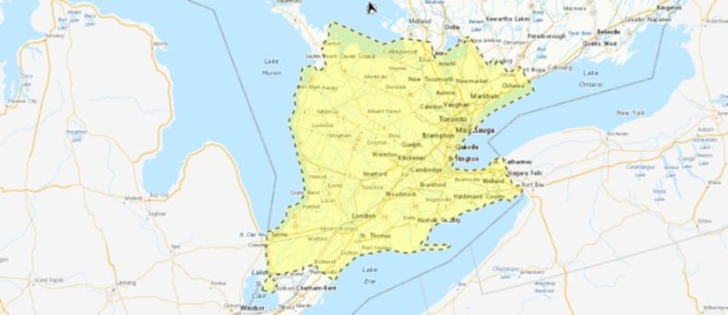
The national weather agency has issued a severe thunderstorm watch, yellow alert, for Toronto and other parts of the GTA, warning of severe weather conditions this afternoon and this evening.

The city could also see wind gusts of up to 100 km/h and Toonie-sized hail during the stormy weather, Environment Canada noted.

“Local utility outages are possible,” the advisory read. “Fast-moving and rapidly rising water can sweep vehicles away and damage infrastructure.”

“I hope you took advantage of the calm and comfortable weather on Tuesday. It was short-lived,” Coulter said on Wednesday.

“Wednesday will see clouds build with a chance for late morning showers and more widespread thunderstorms this afternoon.”

The storms are expected to move out of the GTA today, heading southeast to Niagara Region.

“We should be prepared for some heavy downpours, gusty winds and frequent lightning from these cells,” Coulter said.

Cloudy conditions are expected to clear up on Thursday, which will see sunshine and a high of 28 C.

“There’s a bit of a change in the forecast for Friday. A trough, passing over southcentral Ontario, may bring a few brief light showers on Friday afternoon,” Coulter added.

Friday will see sunshine and a high of 24 C.

On Saturday, mainly sunny conditions and a “seasonably fresh” high of 25 C is expected, Coulter said.

“Showers are expected to return for Sunday afternoon,” he said, adding that “Monday and Tuesday look to be mainly sunny and warm.”