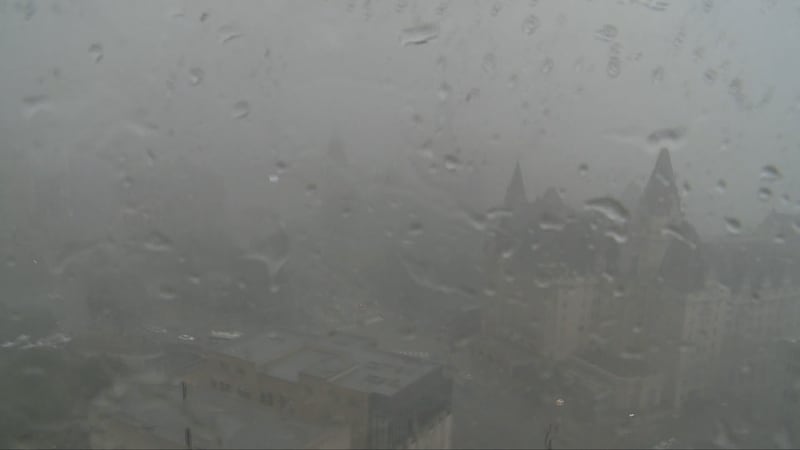
Mother Nature disrupted Canada’s 159th birthday party in Ottawa, as record rainfall and severe thunderstorms flooded roads, knocked out power across the region and forced the cancellation of Canada Day events.
Environment Canada says 118 mm of rain was recorded at the Ottawa Airport on Wednesday after several storms moved through the region between 1 p.m. and 10 p.m.
The orange warning - severe thunderstorm was lifted for Ottawa at 8:35 p.m. and the yellow warning – severe thunderstorm and yellow watch - severe thunderstorm were lifted just after 9 p.m.
The previous rainfall record for July 1 in Ottawa was 58.9 mm, set in 1959.
Several Canada Day celebrations in Ottawa have been cancelled due to severe weather in the area, including the national evening show at LeBreton Flats and fireworks shows in Kanata, Barrhaven, Stittsville and Orléans.
In a statement on social media, Mayor Mark Sutcliffe acknowledged the heavy rain was causing localized flooding on roads and in basements.
“Today’s record rainfall has caused significant flooding and power outages in several areas of the city. City of Ottawa staff and Hydro Ottawa crews have been deployed to respond as quickly and effectively as possible,” Sutcliffe said Wednesday evening.
“I have been in contact with city councillors in many of the affected areas, and my office is working with city staff on a number of measures to respond and support residents.”
Sutcliffe said he has asked staff to suspend garbage limits in “certain wards for the next week” so residents can throw out damaged material.
“I will bring a motion to the next council meeting to waive building permit fees for all residents who need to rebuild their basement because of these storms,” the mayor said.
Hydro outages
As of 8 p.m., Hydro Ottawa was reporting approximately 21,600 customers without power across Ottawa, down from 35,000 customers at 5:40 p.m.
Outages were reported in Kanata, Stittsville, Barrhaven, Beacon Hill-Cyrville and Orléans.
“Due to inclement weather and thunderstorms, we are experiencing multiple outages across our service territory,” Hydro Ottawa said.
“Crews have been deployed to assess damage and restore power where it is safe to do so.”
As of 7 p.m., Hydro One was reporting approximately 18,000 customers still without power across eastern Ontario, stretching from Gananoque and Brockville to Ottawa and the Ottawa Valley.
0 of 29


Flooding on roadways
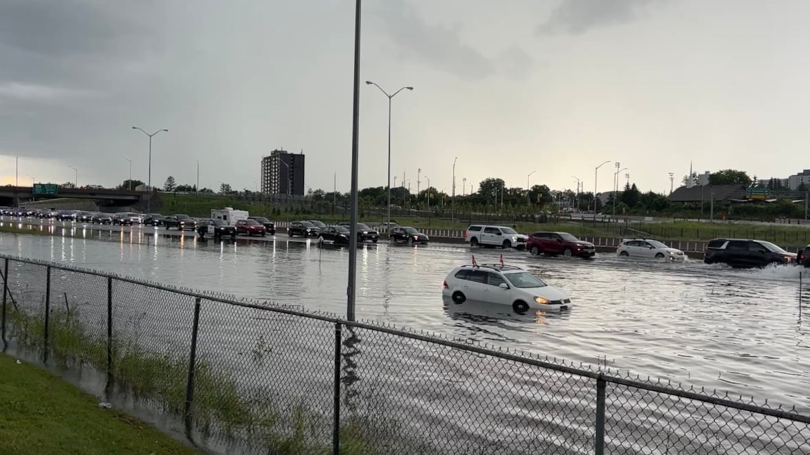
The heavy rain caused temporary flooding of several roads across Ottawa, including on Highway 417 in the Kanata and Nepean areas.
Large puddles covered the eastbound lanes of Highway 417 at Pinecrest and the on-ramp to the highway at 7 p.m., and large puddles could be seen on the highway in the Terry Fox Drive area. Flooding was also reported on Highway 416 between West Hunt Club Road and the Highway 417 split.
Ottawa police reported significant flooding on the following city streets:
- Corkstown Road ad Creekwood Crescent
- Greenbank Road and Banner Road
- Woodroffe Avenue and Knoxdale Road
- Moodie Drive at Highway 417 on-ramp
- Richmond Road and Holly Acres Road
As of 8 p.m., water was receding on roads and highways across the city.
Ottawa Airport
The severe weather forced officials at the Ottawa Airport to temporarily suspend operations on Wednesday afternoon.
According to the Ottawa Airport website, 21 departures have been cancelled since 2 p.m., including the Air Canada flight to London-Heathrow and the Air France flight to Paris.
Travellers are advised to check their flight status Wednesday night and Thursday morning before heading to the airport.
Extreme heat warning
It’s day two of the orange heat warning in effect for Ottawa and eastern Ontario.
Environment Canada is calling for daytime highs of 30 to 35 between today and Saturday, with the humidex making it feel closer to 45.
“The hottest conditions are expected to continue into Thursday, with maximum temperatures up to 35 degrees Celsius expected,” the weather agency said.
“Minimum temperatures of 21 to 25 degrees Celsius will provide little relief from the heat. Hot and humid air can also bring deteriorating air quality and can result in the Air Quality Health Index approaching the high-risk category.”
The temperature hit 30.5 C today, with the humidex making it feel like 43.
The orange level on Environment Canada’s colour-coded scale refers to weather that is likely to cause significant damage, disruption or health impacts. Environment Canada is advising residents to take steps to protect themselves from the heat.
Environment Canada recommends taking the following steps to deal with the heat:
- Limit exposure to the sun and heat
- Wear lightweight and light-coloured clothes
- Close blinds and shades, and open windows if it is cooler outside than inside
- Turn on air conditioning and use fans
- Move to cooler areas of your living space
- If there are no cool areas in your living space, move to a cool public place like a pool, cooling centre, community centre or library
- Drink water before you feel thirsty to replace fluids
The weather agency says air quality may be poor due to the heat and humidity, and the UV index is expected to reach 9 or higher.
Forecast
Showers are expected to end this evening then partly cloudy with a 40 per cent chance of showers. Low 23 C.
Thursday will see a mix of sun and cloud with a 40 per cent chance of showers and the risk of a thunderstorm. High 35 C.
On Friday, expect 33 C and a chance of showers.
On Saturday, expect 31 C and a chance of showers.
On Sunday, temperatures are expected to dip below 30 C, reaching a high of only 29 C.

