
Here is an update on the approaching Nor’easter that is primarily expected to impact parts of Nova Scotia with heavy snow and high wind late Sunday into Monday morning.
Position and timing
As of Sunday morning, the sprawling centre of the storm system was located about 500 km to the southeast of Cape Cod. Far to the north the outermost cloud of the storm already over Nova Scotia, it is a very large weather system. Some light returns on radar are beginning to show in the southwest of Nova Scotia, but snow is still largely not expected to begin there until Sunday early afternoon.
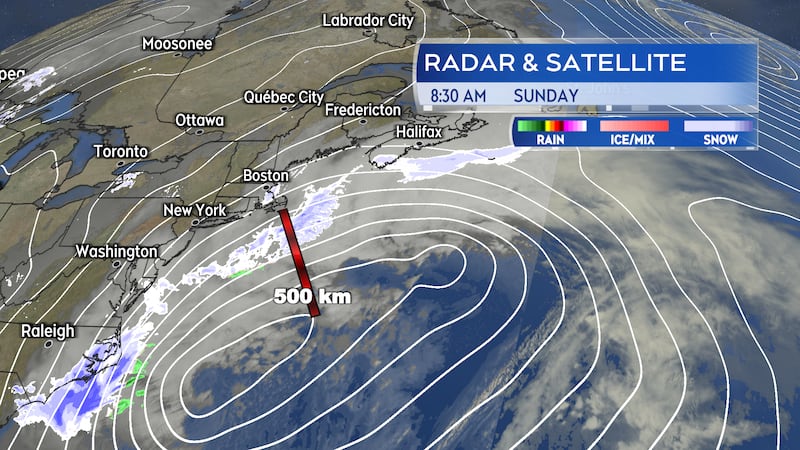
The indicated path of the storm passing just to the east of Sable Island Monday morning has continued into Sunday. That reduced snowfall totals expected in parts of Nova Scotia and Prince Edward Island compared to forecasts made on this past Friday. There are still areas of Nova Scotia that will be impacted by a combination of heavy snow and high wind.
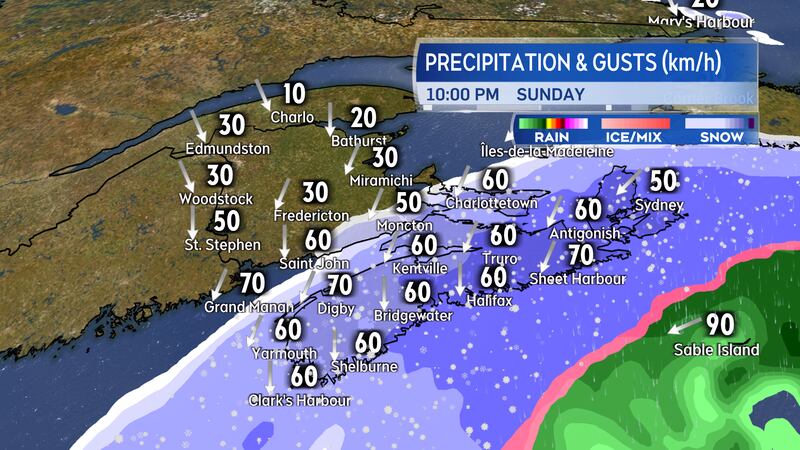
Timing of the weather has remained consistent. Snow develops in Nova Scotia Sunday afternoon through Sunday evening. Weather conditions deteriorating Sunday evening and night. A gradual improvement of conditions, west-to-east, Monday morning through afternoon.
Weather alerts
A Yellow Warning - Winter Storm is in effect for Guysborough, Richmond, and Cape Breton counties in Nova Scotia. A general 25 cm of snow with higher local amounts accompanied by wind gusts of 60 to 80 km/h except 90 km/h on parts of the coast. Extensive blowing and drifting snow expected to develop Sunday night and ongoing into Monday morning.
A Yellow Warning - Snowfall continues for eastern Halifax, Pictou, Antigonish, Inverness, and Victoria counties. The warning calls for totals near 20 cm with higher local amounts possible. Gusty northerly winds will make for areas of drifting and blowing snow Sunday night through Monday morning.
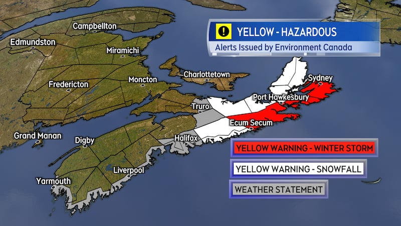
A Special Weather Statement continues for southern Colchester, western Halifax, and coastal Lunenburg, coastal Queens, and coastal Shelburne counties. The statement calls for potential snow of 10 to 15 cm accompanied by northeast gusts of 60 to 80 km/h creating blowing snow. The coastal areas are also under a Coastal Flooding Statement. That advises that higher than normal water levels are expected during the Monday morning high tide.
Kings and Queens counties in Prince Edward Island are no longer under a Special Weather Statement with snowfall amounts trending lower.
Snowfall map
Not much change in my snowfall outlook compared to Saturday.
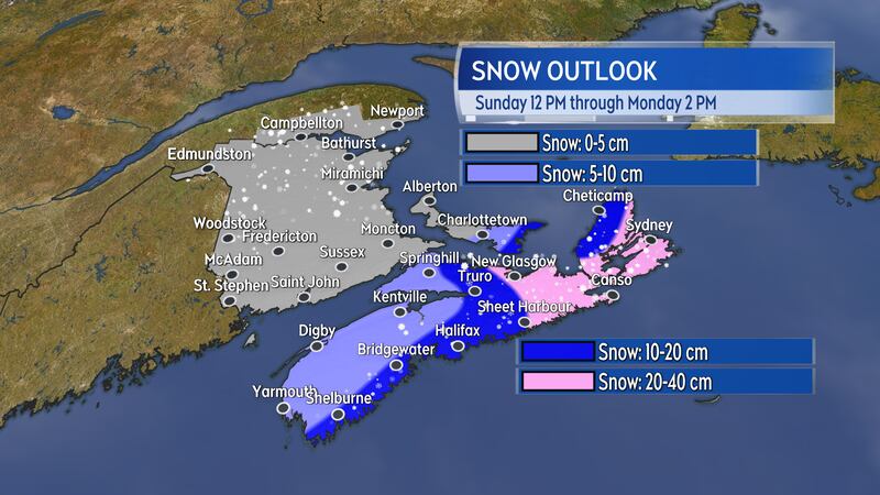
I did increase my snow range in eastern Nova Scotia to 20 to 40 cm. Guidance indicating that snow amounts in Pictou County and parts of Cape Breton, including the Sydney area, could finish in the 30 to 40 cm range. The North Shore and Cape Breton are still at risk of picking up additional snow in flurries and squalls Monday afternoon through Monday night.
While the snowfall has trended lower for Prince Edward Island there is still a chance that the easternmost communities of Kings County could pick up 10 cm.

