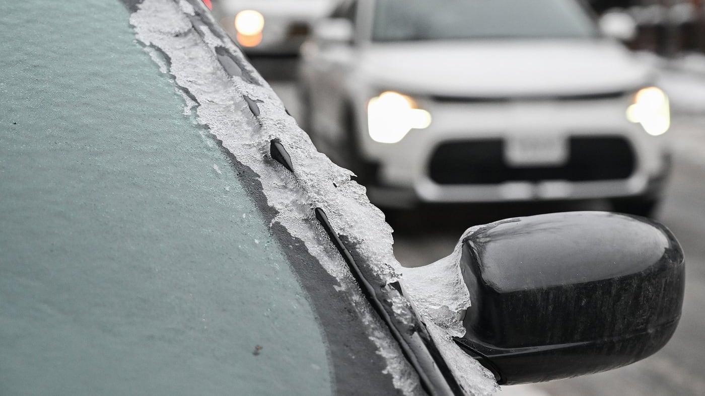
Severe freezing rain advisories have been issued for large parts of Ontario, Quebec and Atlantic Canada.
According to Environment Canada, the “potentially critical freezing rain event” could be “extensive, widespread and prolonged,” leading to power outages, property damage and travel chaos with as much as 20 millimetres of ice expected to coat places like Ottawa and Montreal.
“This is a potent weather system that will develop over the southern United States and then track northeastward into our sectors later this evening,” Environment Canada Warning Preparedness Meteorologist Eric Tomlinson explained during a technical briefing on Tuesday.
“We’re expecting possible delays in transportation, cancellations. Obviously, when we’re talking about a long duration freezing rain event, there is a risk for power outages.”
Starting Tuesday night, a series of low-pressure systems are expected to bring significant precipitation to Ontario. Large amounts of rain and localized flooding is anticipated in southern Ontario, including in cities like Toronto. As the storm tracks to cooler areas to the north and east, precipitation is expected to arrive as freezing rain beginning overnight Tuesday and early Wednesday.
Communities around the St. Lawrence Valley and the Ottawa Valley are expected to see the most severe impacts. Montreal, Ottawa and Quebec City, for example, could experience 20 to 30 millimetres of freezing rain over a 24-hour period starting Wednesday, leading to 10 to 20 millimetres of ice. Environment Canada calls it will likely disrupt services such as public transportation and electricity.
“Prolonged utility outages are likely,” Environment Canada cautioned. “Significant damage to property, including some buildings and trees, is likely due to the weight of ice.”
Speaking to reporters on Tuesday, Tomlinson said conditions will likely be similar to the April 2023 ice storm that devastated parts of Ontario and Quebec, leading to widespread power outages and property damage.
“We’re looking at a similar event in terms of intensity and scope,” Tomlinson said. “As the freezing rain falls, the temperatures will drop in behind the system, and so if we build up a lot of that ice on those tree branches, there’s certainly a risk of large tree branches falling.”

Advisories across Eastern Canada
Weather advisories and warnings that include freezing rain are currently in place for communities across Ontario, Quebec, New Brunswick, Prince Edward Island and Newfoundland, including cities like Sudbury, Parry Sound, Ottawa, Montreal, Quebec City, Fredericton, Charlottetown and Gander. Some regions will see a combination of snow, ice pellets, freezing rain and rain, depending on temperatures. Environment Canada is urging Canadians in affected areas consider postponing non-essential travel.
“It’s a good idea, if you have the time, to stock up supplies,” Tomlinson added. “When we’re dealing with 10 to 20 millimetres of ice buildup on trees, potentially that is enough to make tree limbs fall down and so parking cars away from potentially vulnerable tree branches is a good idea.”
Significant rainfall of 20 to 40 millimetres is also expected to cause flooding in some areas of southern Ontario including cities like Toronto, Kingston and Windsor.
“The saturated or frozen ground will have little ability to absorb this rainfall,” Environment Canada warned. “Heavy downpours may cause flash floods and water pooling on roads. Localized flooding in low-lying areas is possible.”
According to Environment Canada, the freezing rain event will be followed by a return to subzero temperatures starting Thursday, which could complicate and delay recovery efforts as the accumulated ice lingers.
“We’ll see those temperatures drop and remain below zero throughout the day on Thursday,” Tomlinson said. “Compared to 2023, when we actually saw temperatures go above zero the day after the event, and we were able to melt some of that ice, it might be more difficult to do that with those temperatures staying point below zero.”

