


A tornado warning has been dropped for the London region and other areas of southern Ontario as a strong thunderstorm made its way across the region Tuesday evening.
“We’ve had rounds of severe weather moving through southern Ontario through the day and into the evening,” said CTV London Meterologist Julie Atchison. “As we head through the overnight, calmer conditions expected, but this line of storms in advance of a cold front really packing a punch.”
Tornado warnings
As of 7:40 p.m., all tornado warnings have been dropped for the London area and other regions across southern Ontario.
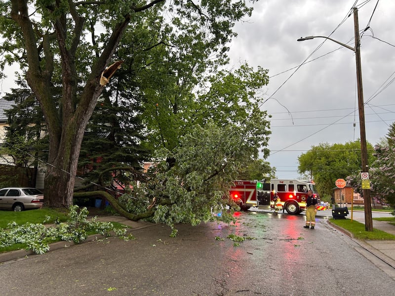
“There have been reports of a funnel clouds, rotation, and some damage in and around the region. So we’ll be shifting through that through tonight and into the coming days,” said Atchison.
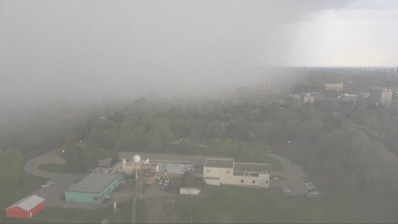
According to the Environment Canada, there were possibly two tornadoes over Western Middlesex County.
The warnings moved east of Middlesex County early in the evening, with tornado warnings issued for Oxford, Norfolk and Brant counties.
Hazards included possible tornadoes, damaging winds of between 110 - 130 km/h and hail the size of a quarter.
There are reports of power outages in south London, mostly due to downed trees.
Thunderstorms before midweek cool down
A heat warning remains in effect, but according to CTV News London Meteorologist Julie Atchison, the passage of powerful thunderstorms Tuesday evening will usher in a cold front.
“That’s all coming to an end with the passage of a cold front that will move into the area tonight,” Atchison explained. “In advance of that front, scattered showers and thunderstorms are developing.”
Showers will end around midnight, with a 40 per cent chance of rain. The thunderstorm risk won’t be over however, with a continued risk after midnight and gusts of up to 40 km/h. The overnight low will dip down to 7 C.
Atchison says weather conditions are set to take a major shift on Wednesday, with the daytime high only cracking 11 C and a mix of sun and cloud. It will be cold on Wednesday night, with the low dropping to 2 C.

Here’s a look at London’s long-range forecast
Tuesday night: Showers ending after midnight then cloudy with 40 percent chance of showers. Risk of a thunderstorm this evening and after midnight. Wind southwest 40 km/h gusting to 70 becoming west 20 gusting to 50 early this evening. Low 7.
Wednesday: A mix of sun and cloud. Wind northwest 30 km/h gusting to 50. High 11. UV index 9 or very high.
Thursday: Sunny. High 19.
Friday: Cloudy. High 19.
Saturday: Cloudy with 70 percent chance of showers. Windy. High 15.
Sunday: Cloudy with 40 percent chance of showers. High 19.
Monday: A mix of sun and cloud. High 23.

