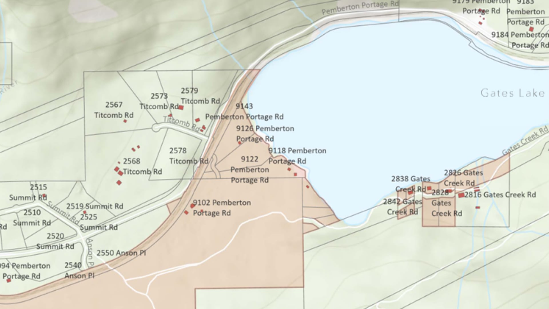
The risk of flooding from a melting glacier that led to two dozen properties in southwest British Columbia being ordered evacuated Thursday will likely be a problem for years, an expert says.
This is the third year in a row that residents in properties in the Poole Creek and Gates Lake area, about 30 kilometres north of Pemberton, are dealing with the threat from Place Glacier, which had similar bursts of water in 2024 and 2025.
Brian Menounos, a professor at the University in Northern British Columbia and Hakai Institute affiliate, said snowmelt and rainfall cause a lake to form on the glacier surface.
Prior to 2024, the lake wasn’t much of a concern, he said.
“It would occasionally drain within a day or two, and it wasn’t a big deal. But largely as the glacier has thinned, that lake basin, the area over which water can collect, has got appreciably larger.”
When the lake gets deep enough, the water has nowhere to go but under the glacier to escape with a flood, putting the homes below at risk.
“Each year there’s more thinning on the surface of the glacier, but not enough to actually cause this depression to level out, if you will,” he said.
“Looking at simple modelling, it looks like this is going to be a problem for the next 10 to 15, perhaps even 20 years.”
The Squamish-Lillooet Regional District said Thursday that there is an immediate danger to life and safety caused by the risk of overland flooding and debris and that RCMP and other agencies were expediting the evacuation.
It said that accommodation in the area is limited and evacuees should try to stay with family and friends, if possible.
Officials said the monitoring system for the glacial lake had reached about the same volume seen during an outburst last year.
Menounos, who is part of the monitoring team, said an aircraft is used to assess the surface elevation of the glacier many times a year and that scientists can then calculate how much water is in the lake.
He said when the meltwater is about 30-metres deep, there is enough pressure for the bottom to release.
“We’re all trying to have a better understanding of … what are the physics, what are the processes by which these lakes drain, how can we come up with effective predictive capacity,” he said.
Menounos said studying glaciers falls under multiple government jurisdictions and departments and that Canada needs a collective monitoring system going forward.
This report by The Canadian Press was first published June 25, 2026

