Some of them are now marked by nothing more than boulders in a sea of crops. Others are outlined by a weathered fence around a lone tree, their headstone leaning and barely legible. And some have disappeared entirely—no marker left to show precisely where the dead were laid to rest.
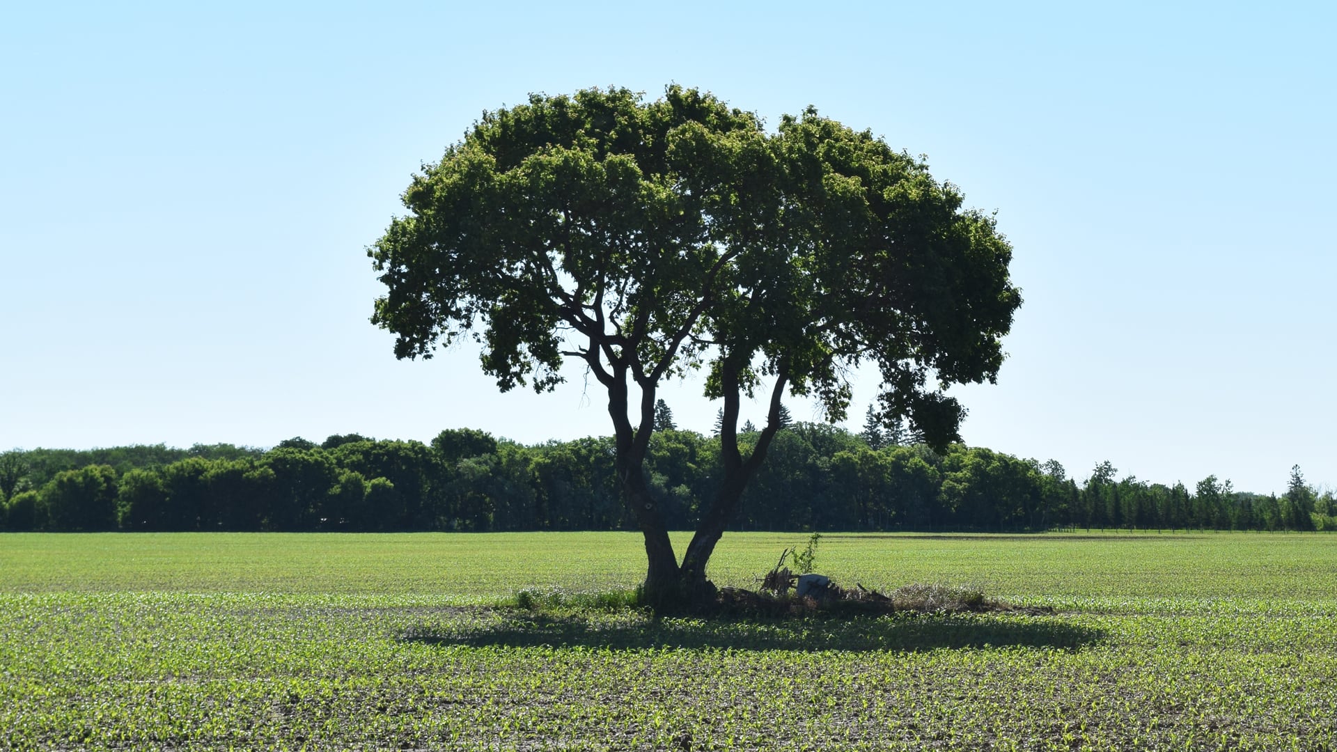
Drive through southern Manitoba and you may notice fence posts rising out of the middle of farm fields, with no path leading in. What you’re passing may be an early Mennonite burial ground—though where exactly it is and who lies there are becoming harder to say.
“The number of these isolated, middle-of-the-field burial sites, infested with weeds, they are disappearing,” said Ernest N. Braun, co-editor of the Historical Atlas of the East Reserve, who has spent years cataloguing these burial sites in the Rural Municipality of Hanover. “I think it’s just the nature of things that they may just all disappear.”

According to Luc Lahaie—who serves as CAO of the RM of Stanley and previously held the same role in Hanover and De Salaberry—more than a hundred of these particular Mennonite burial grounds, unusual by today’s standards, exist across southern Manitoba.
To first understand why these sites exist where they do, Braun said you have to go back more than 150 years, to Manitoba’s first decade as a province. Fearing the loss of military exemptions and religious freedom in the Russian Empire, among other factors, approximately 7,000 Mennonites from colonies in what is now Ukraine immigrated to Canada during the 1870s.
The federal government designated two large land blocks in southern Manitoba for Mennonite settlement—the East Reserve in 1873 and the West Reserve in 1875, named for their position relative to the Red River. Within them, settlers built tight-knit agricultural communities and more than 100 villages.

The first contingent of Mennonites to arrive boarded a sternwheel paddleboat in Moorhead, Minn., before travelling down the Red River to Winnipeg in the summer of 1874—a photograph capturing the historic moment. There, they gathered supplies before heading back upstream to disembark at the confluence with the Rat River and ultimately establishing villages.
A different kind of settlement
Most homesteaders were required to establish a residence on their own quarter-section in order to secure title to their land. Mennonites, however, negotiated settlement arrangements with the federal government before arriving in Canada in large numbers that allowed them to maintain their traditional village-based way of life.
A provision of the Dominion Lands Act known as the Hamlet Privilege, Braun said, let groups of settlers live together in villages while still farming their own individual quarter-sections. There, they recreated the Strassendorf, or street-village—a settlement pattern they had carried with them from their colonies in present-day Ukraine.
Braun said the villages were typically organized around a single street running parallel to a creek or along a high ridge, oriented by landscape rather than by railroad or the municipal road grid that developed later.

Within the first decade of settlement, he said nearly every village on the East Reserve had its own cemetery—and likely more than one.
“However, almost all of these villages were dissolved by World War One, and the houses were removed and dismantled. And since there were no stone or concrete basements, the village area was simply plowed over and became crop land over time,” Braun said. “The land changed ownership, and the new owners had no connection to the dead buried on their land.”
Most Mennonites of that era, he added, believed that erecting a stone monument for oneself was a sign of “excessive pride”—and gravestones before 1900 were rare, instead denoted by field stones or wooden markers. Some of the grave markers were also made of concrete with the names and dates written in.
“The cemeteries became a nuisance and a source of weeds—almost all of them were plowed under, the cemetery stones shoved to the side, if there were any, and the location was lost,” Braun said. “That is sort of the normal story of those village cemeteries.”
Village cemeteries remain
Still, traces of some of the Mennonite village cemeteries survive today, isolated on private farmland.
Just north of Mitchell stands a monument marking the Bergthal CMC Cemetery, established for the village of Bergthal. A trip to the site shows a stone monument bearing 66 names on a small concrete pad.
Nearby, the Hochfeld CMC Heritage Cemetery, established in 1874, still holds some of its original gravestones. The village of Hochfeld on the East Reserve disbanded in 1911, not to be confused with the present-day community near Winkler bearing the same name.

“That village is entirely gone. But of course, the cemetery is still there,” said Garth Doerksen, senior curator of Steinbach’s Mennonite Heritage Village. “That’s another one that is in the middle of a quarter section that is not maintained… it’s so overgrown with grass.”
One of those gravestones, commemorating 20 children who died of Spanish flu or diphtheria between 1918 and 1920, is currently on display at the Mennonite Heritage Village. It’s part of an exhibit exploring how faith shaped health and healing in Mennonite communities.
Doerksen said he secured permission from the church bishop and landowners to display the marker, promising its return after the exhibit—but he questions how much time the gravestone has left, a fate shared by many memorials of that era.
“It’s already fractured to a point where, if I go put it back and leave it there for another ten years, it may have disintegrated,” Doerksen said.

South of Blumenort, a cairn and short concrete posts mark the site of the Blumenort Original Cemetery, with the names of those buried there between 1874 and 1919 inscribed on the cairn.
Royden Loewen, a retired history professor at the University of Winnipeg, said his family has owned the land the cemetery sits on for over a century. The village itself disbanded in 1910, he said, and the cemetery—which he estimates at roughly 100 feet by 30 feet—is all that remains to mark the area where it once stood.
“Besides just being a cemetery, they’re really valuable for marking an earlier history,” he said. “It’s the only tangible evidence we have of these villages… there is very little evidence of any of them."

He said the site draws a couple of visitors a year who come to see it.
Beyond village cemeteries, Braun said family burial sites were another common outcome of the era — a practice rooted in both geography and practicality.
In the East Reserve’s early years, he said only a handful of Mennonite churches served the more than 50 villages. The nearest one could be over a dozen kilometres away—a journey measured not in minutes, but in hours when the only transportation was oxen.
“To go there by ox to bring your loved one, have the funeral, with everybody else having to come there—it would have been incredibly time-consuming and cumbersome,” Braun said.

When someone died, some families buried their loved ones on the property—at the edge of a field, in the garden, or within a shelterbelt.
Mennonite church funerals only became the norm after the First World War, Braun said, when horses and eventually motor vehicles made distance less of a barrier.
‘They are disappearing’
Braun said within the boundaries of the East Reserve, he’s aware of approximately 80 private Mennonite burial sites, about two-thirds of which are unmarked. However, he said the number of these sites has been dwindling—noting that some farmers have simply opted to plow them over.
“I have actually been in touch with some of the farmers who have done this,” Braun said.
He said what is believed to be the oldest surviving Mennonite headstone known on the East Reserve, dating to 1877, was ultimately rediscovered in 1979 after a farmer snagged it on his cultivator.
That gravestone was then kept in the farmer’s garage until decades later, when Braun said it was donated to the Mennonite Heritage Village in 2021 during a ceremony with descendants present.

Doerksen said he recalls helping his grandfather, decades ago, compile information on graves in the Blumenort area, noting that people of his grandfather’s era knew of cemeteries that had been removed due to the “inconvenience” of their location.
One of Doerksen’s great-great-grandfathers, who died in 1882, is among those buried in the middle of a field south of present-day Kleefeld. The precise location is no longer known, he said, as the original marker disappeared. The site is now marked by a boulder with a modern granite marker leaning against it.
Doerksen said he remembers loading a lawnmower into the back of his grandfather’s car in the 1970s and ’80s to maintain the site.
“[My grandfather] told me at that time, ‘Someday this will be your responsibility,’ and thankfully I know where the place is,” he said. “I’ve certainly maintained it a few times, but if it wasn’t somebody like myself, I’m not sure who else would know about it.”
While Braun said he understands farmers’ frustration—that manoeuvring large equipment around a small, isolated patch of field can be a constant hassle—he said they remain protected under law.

Under the province’s Cemeteries Act, anyone who willfully destroys or removes a monument, gravestone, or other structure placed in a cemetery can, if found guilty, face a fine of $1,000 to $10,000, up to a year in jail, or both. The Act defines a cemetery as land in which human remains have been buried.
In a statement, a provincial spokesperson said privately owned, landlocked cemeteries such as these are considered unlicensed cemeteries and that no provincial legislation requires landowners to report these sites to the Manitoba government. Landowners are responsible for upkeep in these cases, the spokesperson said, “and remedies are left to the courts.”
The statement added that the physical states of such sites are governed by provisions of the Cemeteries Act, such as requirements for enclosure and drainage.
‘No role in securing or maintaining access routes’: Province
For those marked sites that still remain, viewing access can also be a challenge.
A provincial spokesperson said the province has “no role in securing or maintaining access routes” to these unlicensed, privately owned cemeteries.

The spokesperson added that the Consumer Protection Office (CPO)—which enforces the Cemeteries Act and licenses certain cemeteries in Manitoba—recommends that anyone wishing to visit a burial site of this nature first contact the landowner to request access.
“Where no access is granted, or no timely response is received, the CPO would then suggest the person may wish to seek independent legal counsel toward access being granted through a court process,” the statement said.
In Braun’s experience, getting permission to cross private property usually isn’t the issue. He said one family has even granted him permission to bring tour groups onto their land, which includes the cemetery of his ancestral village. The harder part, he said, is figuring out who currently owns the land—and making sure the timing is right.
“The problem comes with summer, when the crop is in and blooming or putting on seed. This understandably does not work very well, so it’s a timing issue,” Braun said. He added that most people give up at the stage of trying to track down who the landowner is.

Still, Braun said some farmers go out of their way to ensure these sites are preserved in perpetuity. He pointed to a monument commemorating those buried at the Alt-Bergfeld Cemetery, where the original markers have long since disappeared.
He said one farmer took his payloader, gathered the largest rocks he could find, and surrounded the memorial stone with those rocks.
“He said, ‘You know, none of my employees are going to come close to this (memorial) stone, because if they do, they’re first going to have to wreck the $300,000 equipment they’re sitting on,” Braun said.
“So this was his guarantee that that stone would never be touched… I call it the Mennonite version of Stonehenge.”

Doerksen also credits the volunteer effort on Find a Grave—an online database of cemetery records where people input site coordinates, upload photos, and share available information—as helping with preservation efforts.
“So there are success stories… but the trajectory is not encouraging,” Braun said. “Some plots that were relatively well maintained a dozen years ago, when I went to look for them, have gone wild.”
Locating a long-lost cemetery
Braun, who also sits on the EastMenn Historical Committee, part of the Manitoba Mennonite Historical Society, said work has even been done to look into the possibility of relocating a long-lost cemetery known to exist in a farmer’s field southeast of Niverville.
He said approximately 30 burial sites, mainly children, are known to exist on a ridge from documentation, a few hundred yards from immigration sheds that once stood for the East Reserve.
In 1874, Jacob Shantz—a Mennonite businessman from Ontario who assisted with immigration—along with his Métis employees, built four immigration sheds at the intersection of what are now Shantz and Hespeler roads in Manitoba, he said.

“(The sheds) were very rough; they had no shingles, they had no floor. These were just places where people could be temporarily until they could find a place where they could establish a village and then apply for a homestead,” Braun said.
“While they were there, little kids died. Occasionally, a mother died during childbirth. Occasionally, a child died on the riverboat and was taken onto the land,” he said.
Braun said he’s looked into pursuing ground-penetrating radar to locate the graves on behalf of the committee but added that right now, the costs are prohibitively expensive to proceed.
“It is definitely on pause,” he said.

“We’re the only people who really are interested in this. The average person doesn’t even know the place exists and certainly would not be willing to spend any energy or money on it… It’s either a historical community that does it, or it never gets done.”
In May 2022, the EastMenn Historical Committee unveiled a monument for the Shantz immigration sheds at the site, with an interpretive plaque that shows the approximate site of the cemetery.
Ultimately, Braun said, his hope is simply that people come to understand why these sites are there.
“Practically, they are there because of the way we lived back then in villages… We did not deliberately put them there because we wanted to frustrate people,” he said.
“I think if at least the record is there and the record is clear as to why they’re there, then I think I would rest content.”

