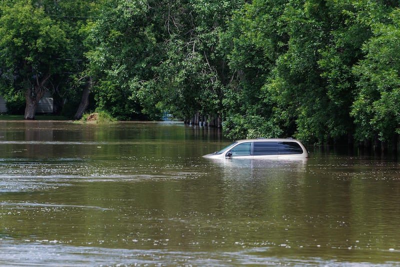
WINNIPEG – Heavy rainfall has triggered flooding in communities across southwestern Manitoba.
Powerful storms, including large hail and tornadoes have caused widespread damage across the region.
Swan River, more than 480 kilometres northwest of Winnipeg, received 269.4 millimetres of rain in June, according to data from Environment and Climate Change Canada (ECCC). This marks the most rain to fall on the town in a century.
Other areas, including lake Winnipeg and Brandon, received between 150-170 millimetres of rain.
John Hanesiak, a professor of atmospheric science at the University of Manitoba, says one of the biggest factors behind the flooding was the slow movement of the storm systems that went through southern and western Manitoba, allowing rainfall to accumulate over extended periods.
“It’s a little unusual to see weather systems sort of form and decay right over top of the prairies, all in the same sort of area, and they are rather slow moving,” he said. “So, this has probably contributed to some of what we’ve seen.”
ECCC meteorologist Chloe Katsademas said the intensity and persistence of some of the storm systems stood out.
“Some of those systems were pretty heavy, and I think it’s not something that I’ve seen a lot of,” she said.
Several communities, including Brandon, the province’s second-largest city, have declared states of emergency due to rising waters.
Several inches of water also remain on farmers’ fields in the province’s Interlake region.
Scientists connect recent weather to changing climate
Researchers say the storms are consistent with a pattern of increasingly intense weather events linked to a warming climate.
As global temperatures rise, the atmosphere is able to hold more moisture. That additional moisture can fuel heavier rainfall when storm systems develop.
“When the clouds do precipitate, they tend to precipitate more to a greater degree, and I think we’re seeing that, not just in Canada, but globally,” Hanesiak said.
“In terms of thunderstorms, that just fuels even more fire to the flame. It just exacerbates the whole system.”
“Water vapour also is actually gas, so as the planet warms, you get more water vapour in the atmosphere, which allows more radiation to be trapped in the Earth’s climate system, and once again, it sort of exacerbates the whole climate system and affects our weather in general,” he said.
Curtis Hull, the project director with Climate Change Connection in Winnipeg, says the current severe weather seen in southern Manitoba is something that has been predicted by climate scientists for decades, saying warming temperatures globally are creating change to the climate.
“They’re more severe when they happen and they’re longer lasting,” he said.
“Unless we curtail our emissions as a species very quickly, we’re looking forward to much more severe, believe it or not, events in the future, more frequent, more severe and longer lasting.”
He believes changes to the jet stream, made up of fast-flowing, high-altitude winds, is contributing to the more active weather we are seeing today.
“It’s been due to the inordinate warming of the northern latitudes versus the equator,” he said. “As a consequence, the jet stream is meandering just like a slow-moving river.”
“When it meanders far north, you get hot air from the equator pushing northward, and that’s what’s happening in Europe right now. African weather is being pushed north, and it locks in place. This is a relatively new phenomenon,” he said.
As for what’s to come throughout the rest of the summer, some meteorologists believe more of this unpredictable weather is still to come.
Meteorologist Brian Proctor recently told CTV News the beginning of “severe weather season” is just starting.
“For the next three or four weeks, we’re in the peak of that season, so I don’t see a whole lot of change going on, especially with the moisture availability out there,” he said.