Wildfires burning across northwestern Ontario have forced multiple communities to evacuate, with hot, dry conditions and high winds fuelling aggressive fire behaviour across the region.
According to the Ministry of Natural Resources, as of Monday evening, there were 128 active wildland fires in the Northwest Region, with 53 of those not under control. The ministry reported 31 new wildland fires were discovered on July 13 alone.
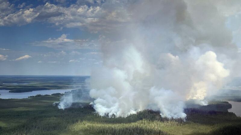
Ontario Provincial Police said mandatory evacuation orders are in place for Armstrong, Collins First Nation, Cushing Lake, Gakijiwanong Anishinaabe Nation (Lac La Croix First Nation) and surrounding area, Lac des Mille Lacs First Nation and surrounding area, and Whitesand First Nation.
“If you are in these communities and need assistance (with) evacuation, please call 911,” the OPP said in a social media post early Tuesday morning.

Evacuation preparations
Other communities, including Gull Bay First Nation, Ignace, Pickle Lake and Upsala, are being monitored, and police urged residents to stay informed and be prepared to act quickly should further orders or advisories be issued.
“Residents in some locations may have been directly advised by emergency personnel to evacuate as a precaution,” wrote OPP.
“Please continue to monitor for any updates.”
OPP said it began assisting MNR fire crews with the response on July 13 at about 4 p.m., covering areas including Rainy River District, Armstrong, Whitesand First Nation, Collins First Nation, Gull Bay First Nation, Lac des Mille Lacs First Nation, Gakijiwanong Anishinaabe Nation, Pickle Lake, Ignace and Upsala.
Provincial police added they have deployed their aviation services, Emergency Response Team and operational support teams to assist with evacuations, enforce road closures and help ensure public safety.
Highway closures
The OPP has confirmed multiple road closures remain in effect across the affected region.
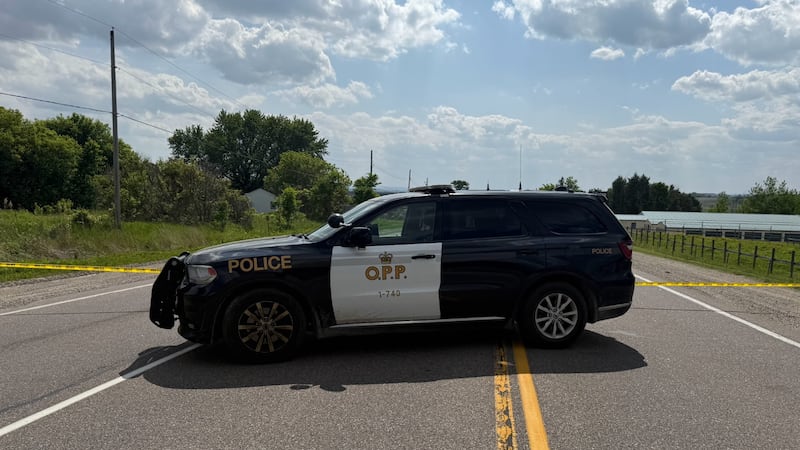
- Highway 11 is closed in both directions between Highway 633 and Highway 623, east of Atikokan.
- Highway 599 is closed southbound between Highway 516 and Mishkeegogamang First Nation.
- Highway 527
For up-to-date road closures and travel conditions, check 511on.ca
“OPP is urging the public to stay informed and plan ahead,” the police service wrote.
OPP has advised those evacuating to pack essential items, including medications, identification, passports and important documents.
Police urged the public to stay away from affected areas and refrain from attending wildfire scenes to take photos or videos, and to avoid non-essential travel in affected areas.
“Remain away from evacuated areas until authorities have advised it is safe to return.”
— Ontario Provincial Police
Authorities have also asked the public to keep roadways clear so emergency personnel can carry out their work safely and effectively.
OPP have also advised the public to avoid the area of Collins, Ont., due to wildfire activity affecting rail operations. Police said three trains carrying combustible and flammable materials have been stopped and staged between mile markers 20 and 23 of the Allanwater Subdivision, near Collins, due to the fires in the area.
Authorities said while there is no immediate threat to public safety, emergency responders and railway officials are working together to assess conditions and support ongoing safety measures.
As a precaution, police asked members of the public to stay away from the affected area and refrain from entering the railway corridor.
“OPP continues to work closely with fire officials, emergency management partners, railway representatives, and other responding agencies to ensure public safety,” police said in a news release.
For emergencies, the OPP directed the public to call 911.
Large fires burning
Among the most significant fires is Fort Frances 14, located approximately 35 kilometres southwest of Upsala near Byers Lake. The fire has grown to 1,749.7 hectares and remains not under control. The ministry reported 13 FireRanger crews, 10 Type-2 firefighting crews and 12 helicopters are assigned to suppression operations.
“Increased fire behaviour was observed today as hot, dry conditions persist,” the ministry said in its daily wildfire update.
Fort Frances 15, burning in Quetico Provincial Park south of Pickerel Lake, has reached 1,751.9 hectares and is also not under control.
Other large fires include Dryden 35 at 500 hectares near Weaver Lake, Dryden 34 at 400 hectares near Harmon Lake, Thunder Bay 56 at 400 hectares near Wawang Lake, and Thunder Bay 54 at 400 hectares near Brett Lake.
Sioux Lookout 84, located near DeLesseps Lake approximately 71 kilometres south of Mishkeegogamang First Nation, has grown to 143 hectares.
For up-to-date forest fire information, visit ontario.ca/forestfire or consult the ministry’s interactive fire map.
Restricted Fire Zone takes effect
Due to high to extreme forest fire hazard conditions, the MNR will implement a Restricted Fire Zone effective Wednesday at 12:01 a.m. local time for the Northwest Region and parts of the Northeast Region.
Portable gas or propane stoves may be used for cooking and warmth but must be handled with extreme caution. All burning permits are suspended.
Airspace restrictions over fire zones
The ministry has issued formal Notices to Airmen, commonly known as NOTAMs, for airspace above two significant fire zones, restricting civilian aircraft from entering the areas.
A NOTAM is currently in effect for the area of wildland fire Fort Frances 14, northeast of Byers Lake. A separate NOTAM has also been issued for Nipigon 16 near Kasabonika Lake First Nation.

The ministry said the restrictions are intended to protect firefighting aircraft operations and ensure the safety of crews working at low altitudes over active blazes.
Ongoing fire activity
The MNR added that Ontario firefighting aircraft and Fire Ranger crews are responding to multiple new fire starts and heightened fire behaviour as conditions persist.
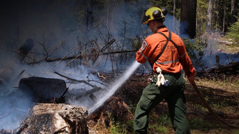
“The current fire hazard to remain, along with the potential for problematic fires to continue and expect a continuation of the increased forest fire activity into the foreseeable future,” the ministry wrote.
Environment Canada’s forecast has much of northern Ontario under a severe heat warning Tuesday, with predicted highs of 36 C and the humidex reading making it feel as hot as 40 C.
OPP said its thoughts are with everyone affected, particularly those forced to leave their homes and communities.
“OPP recognizes the significant impact evacuations and wildfires can have on individuals, families and communities.”
— Ontario Provincial Police
The service said it remains committed to working alongside emergency management officials, Indigenous communities, municipal partners and the MNR to support evacuation efforts, protect lives and property and ensure safety throughout the region.

