Another round of severe storms is on tap for late afternoon/early evening Tuesday in central and north-central Alberta.
Storms developing later this afternoon have the potential to produce large hail, damaging wind gusts and downpours, possibly leading to more flooding in the Edmonton region.
There is also the potential for one or more of the storms to produce a tornado, particularly west and/or northwest of Edmonton - most likely between 4 p.m. and 8 p.m.
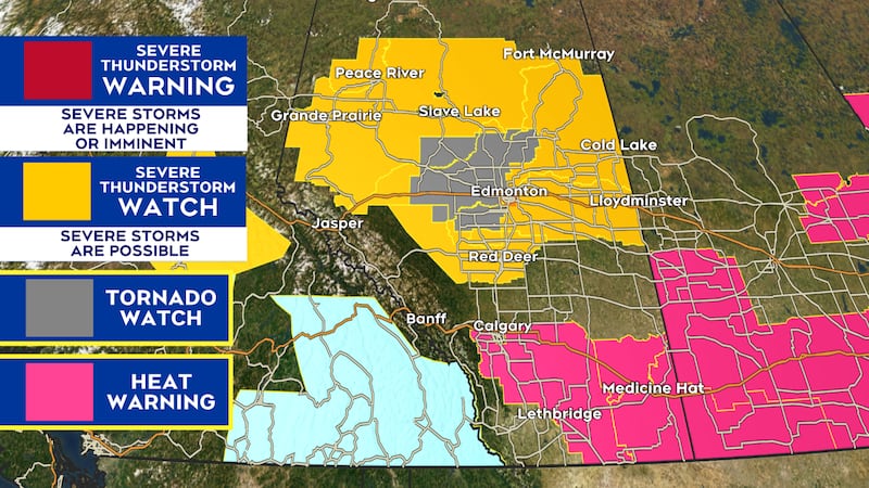
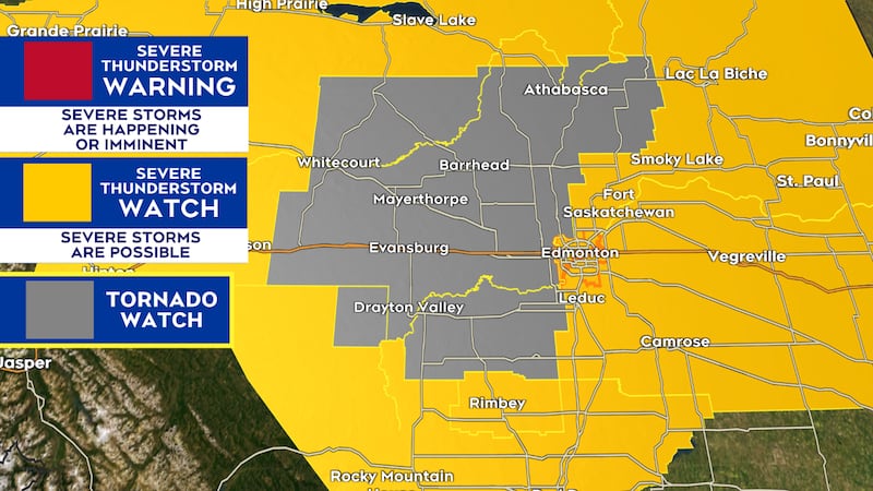
The city of Edmonton is under an orange-level severe thunderstorm watch as of 2 p.m. Surrounding areas are under a yellow-level severe thunderstorm watch.
The elevated orange-level alert is due to the high possibility of localized flooding in parts of Edmonton given how saturated the ground is.
There is also a tornado watch for areas southwest, west and northwest of Edmonton.
Remember: A watch means possible severe weather (and most areas under a watch will not see severe weather). A warning means the severe weather is happening, or imminent.
Here are the severe weather alerts as of 2 p.m.
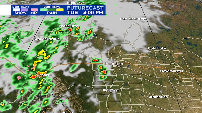
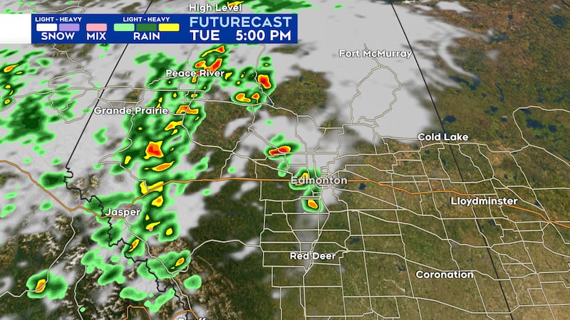
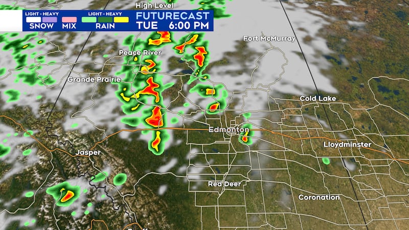
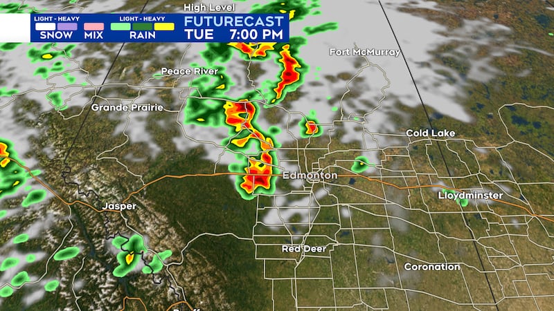
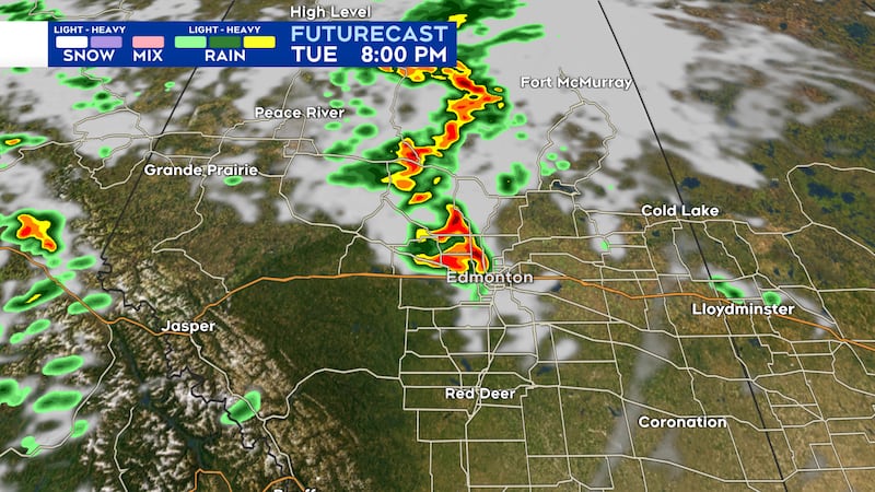
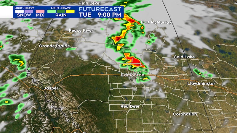
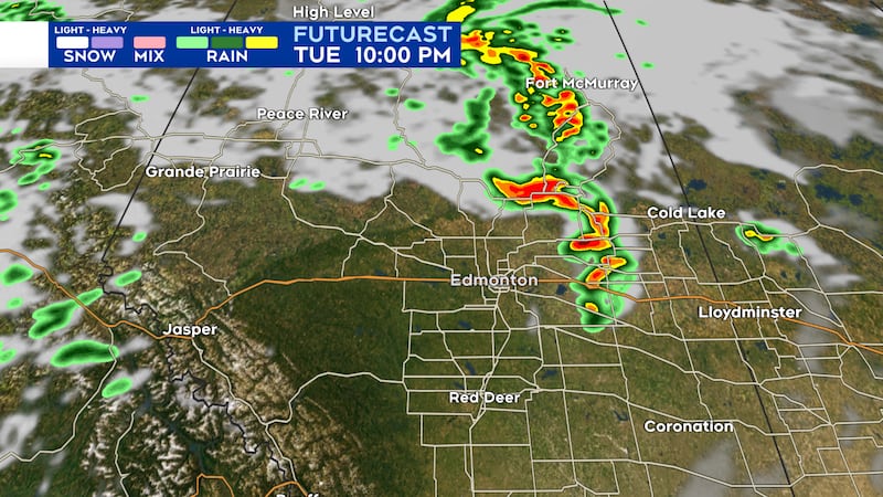
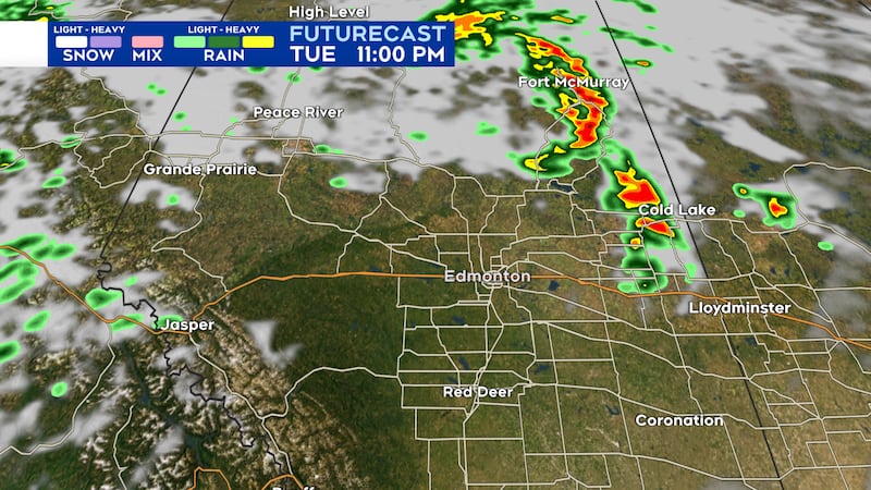
Here is a rough timeline of the storms for late Tuesday afternoon and Tuesday evening.
NOTE: This is just model guidance to be used as a rough estimate of timing and location of storms. Actual storm location and timing will likely vary to some extent.
This is a developing story and will be updated throughout the day.