It was a “wild end to the year” for weather in Ontario, according to Environment Canada as the national weather agency projects what’s to come in January.
From crippling cold snaps to record high temperatures, the weather agency says December was a “roller coaster ride” across the province.
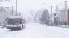
Most of the month saw above average temperatures, but drastic swings disrupted that trend in southern Ontario. Between Dec. 23 and 26, daily temperatures plummeted 10 degrees below normal as a wicked winter storm cascaded across the province.
But for the closing days of 2022, “winter decided to take a holiday,” Environment Canada said in its December weather summary.
What’s next?
Southwestern Ontario saw below average precipitation for most of the year, but December was more wet and that trend is expected to push through this week.
In parts of southern Ontario, a rainfall warning went into effect on Tuesday and is expected to stretch into Wednesday morning.
Rainfall between 15 to 25 millimetres is expected in Hamilton and Niagara. The weather agency warns locals to keep children and pets away from creeks and river banks due to potential flooding in low-lying areas.
“Rain develops this morning, then becomes intermittent tonight. Another round of widespread rain will develop Wednesday afternoon and continue into the evening,” Environment Canada stated in a warning on Tuesday.
The rainfall warning also spans across Windsor and London, but no alerts have been issued for the Greater Toronto Area.
For the agency’s January outlook, above normal temperatures are expected for most of the province, along with higher than average precipitation from the Lake of the Woods, through Lake Superior, to northeastern Ontario, as well as areas east of Georgian Bay.


