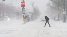
A polar vortex expected to bring bitterly cold temperatures to parts Canada in early February could result in “nasty” storms hitting Ontario, experts say.
Environment Canada’s Chief Meteorologist David Phillips told CTV News Toronto it appears the polar vortex will be confined to the western and northwestern parts of the country, while most of Ontario is not in its trajectory.
He said current models for February in southern, eastern and central Ontario show warmer than normal temperatures are expected.
And while this may seem like a good thing, Phillips says people should think again.
“We’re not sort of standing on the sidelines [in Ontario],” Phillips said. “Because one of the effects of the polar vortex is that when you get cold air duking it out with warm, moist air, boy, you get lots of weather.
“We may be saying, ‘Haha, we’ve got the warm [temperatures], and you’ve got the cold,’ but this might bite us in the butt because we may pay for it with some nasty, precipitation-yielding systems.”
The Weather Network’s meteorologist, Doug Gillham, told CTVNews.ca the cold air from the northwest and warm air from the southeast could collide and create some volatile weather for southern Ontario when the polar vortex shifts.
“Being [in] the battle zone means we’ll get a more active storm track, which means a lot of messy weather systems, the potential for heavy snow, but also the potential for ice and rain,” he said.
Meanwhile, The Weather Network is forecasting the “warmest winter on record” for eastern Canada, with Toronto set to see its first winter with an average temperature that sits above freezing.
Currently, The Weather Network is actively tracking a jet stream making its way across the Great Lakes that could bring about snow throughout southern Ontario throughout the rest of January.
- With files from CTVNews.ca's Megan DeLaire


