The smoke from nearly 90 wildfires burning in Alberta has reached Ontario.
Environment and Climate Change Canada said residents in the northeastern, eastern, and southeastern parts of the province will observe hazy skies on Tuesday as the fires continue.
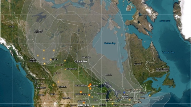
Peter Kimbell, a warning preparedness meteorologist at Environment Canada, said the smoke from Alberta actually travelled north before arriving in Ontario on Monday.
“The smoke has made a long trip. Basically across the Arctic in a sort-of horseshoe pattern before plunging southward over southern Ontario and the Greater Toronto Area,” he told CTV News Toronto over the phone on Tuesday.
Images released by the agency from Earlton and Peterborough, Ont. showed the sun shining through a darkened haze on Tuesday. However, no air quality statements have been issued likely due to the height of the smoke, Kimbell explained.
“We don’t have any poor air quality as a result of [the haze] because the smoke has really kind of risen into the higher levels of the atmosphere,” he said.
As for how long the haze is going to last, Kimbell said that depends on the smoke’s trajectory.
“It probably won’t persist as those winds push eastward. It shouldn’t really affect Ontario for that long, initially. It could very well return later, but at this point it’s not going to persist for too long.”
Alberta Premier Danielle Smith declared a state of emergency on Saturday as tens of thousands of hectares continued to burn. Of the 89 active fires in the province, 24 are listed as out of control.
Smith has called the situation that has left more than 29,000 people displaced “unprecedented.”


