ADVERTISEMENT
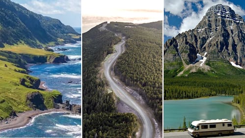
These 15 unforgettable Canadian road trips will fulfill your bucket list dreams
From the iconic Cabot Trail in Nova Scotia to Alberta's breathtaking Icefields Highway and the rugged landscape along Dempster Highway, here are iconic roads trips across Canada.
Updated:
Published:
Image 0 of 51
Distance: 1,700 kilometres
This highway, also known as the Trans-Labrador Highway, starts in Baie-Comeau, Quebec, loops through Labrador, down along the Atlantic Ocean and back to the Quebec border - a route for true adventurists through the vast land inhabited by the Innu and Inuit for thousands of years.
(Newfoundland and Labrador Tourism)
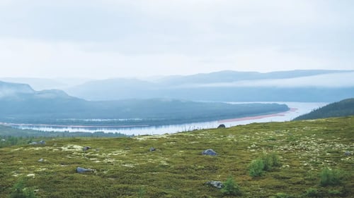
Expedition 51° passes through the mining town of Labrador City, Churchill Falls, Happy Valley Goose Bay, Red Bay and Havre-St-Pierre.
(Newfoundland and Labrador Tourism)
Travellers can visit Red Bay National Historic Site, a UNESCO World Heritage Site, Mealy Mountains, boreal forest and isolated coastal villages. There is also a good chance of experiencing the Northern Lights at night.
(Newfoundland and Labrador Tourism)
(Newfoundland and Labrador Tourism)
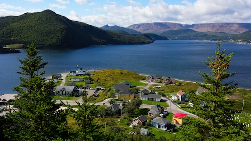
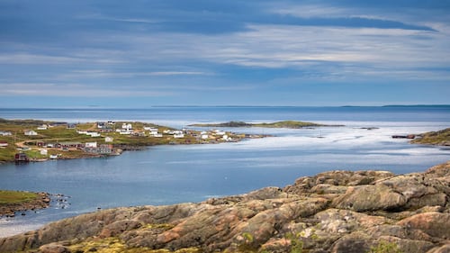
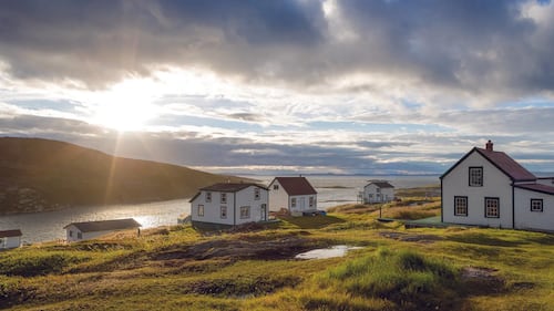
Distance: 687 kilometres
This western route starts in Deer Lake, hits the northernmost tip of Newfoundland, and ends in St. Anthony, and area part of Iceberg Alley and close to Fishing Point Municipal Park.
The Tablelands of Gros Morne National Park are pictured over Bonne Bay, Nfld., on Wednesday, Sept. 4, 2024. THE CANADIAN PRESS/Sean Kilpatrick
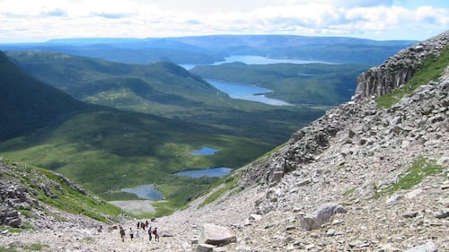
Two UNESCO World Heritage Sites can be found on the Viking Trail: Gros Morne National Park and L'Anse aux Meadows National Historic Site, an 11th-century Viking settlement.
Gros Morne has ‘soaring fjords and moody mountains’ towering above beaches, bogs, forests and barren cliffs, according to Parks Canada.
Hikers climb Gros Morne Mountain in western Newfoundland. THE CANADIAN PRESS/Melanie Patten
Meanwhile, the northern region has the longest iceberg-watching season and is a good place to watch whales, according to Newfoundland and Labrador Tourism.
(Newfoundland and Labrador Tourism)
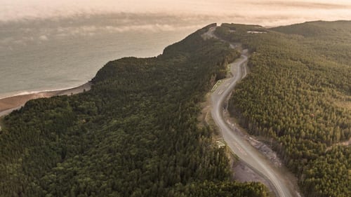
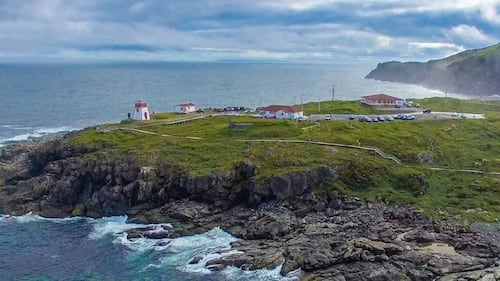
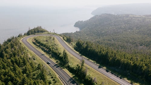
Distance: 330 kilometres
This trip along the iconic Fundy coast begins in Saint Andrews, down to the Fundy Isles, through Saint John and Fundy National Park, and ending at the famous Hopewell Rocks.
(Tourism New Brunswick)
The Bay of Fundy, situated on the unceded territory of the Mi'gmaq people, features the world’s highest tides, according to Parks Canada.
View of Fundy Trail Parkway. (Parks New Brunswick)
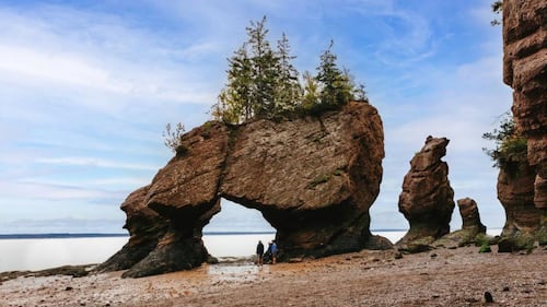
At Fundy National Park, travellers can paddle through rising waters, “walk the otherworldly ocean floor at low tide”, or visit trails that lead to waterfalls in Acadian forests, says Parks Canada.
The Hopewell Rocks Provincial Park. (Tourism New Brunswick)
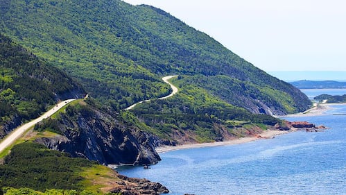
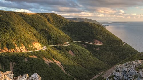
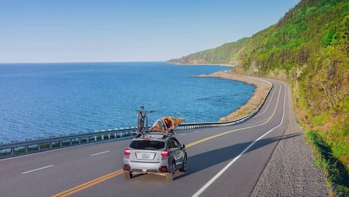
Cabot Trail, Nova Scotia
Distance: 298 kilometres
Considered one of the world’s most beautiful drives, the trail offers breathtaking coastal views through Cape Breton island in Nova Scotia.
(Cyclotourisme Canada)
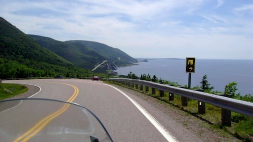
Much of the route in one of Canada’s most-visited regions weaves through Cape Breton Highlands National Park, which offers striking ocean views, deep river canyons, and dramatic forested plateau, according to Parks Canada.
This July 13, 2010 photo shows the road along the Cabot Trail in Cape Breton, Nova Scotia. THE CANADIAN PRESS/AP-Glenn Adams
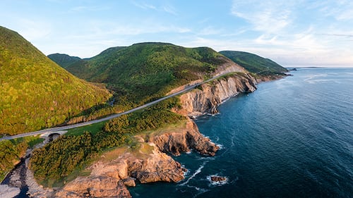
Other landmarks on the trail include Cape Smokey gondola, Acadian villages and Mi'kmaq communities, Alexander Graham Bell National Historic Site, Pleasant Bay and Ingonish beach.
(Parks Canada)
(Facebook/Cabot Trail Relay Race)
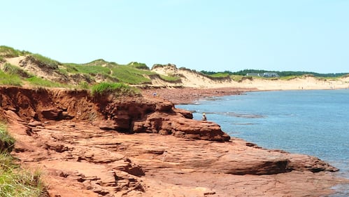
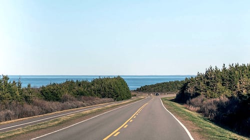
Distance: 253 kilometres
This stunning coastal route starts in Charlottetown and weaves around central Prince Edward Island, offering famous sites, stunning ocean views and several otherworldly red-sand beaches.
(Parks Canada)
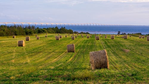
The central route features the famous Anne at Green Gables Heritage Place, located in Cavendish. Meanwhile, Skmaqn—Port-la-Joye—Fort Amherst National Historic Site commemorates the Mi'kmaw, French, Acadian and British history on the Island.
(Tourism PEI)
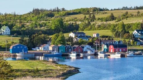
Travellers can also visit Prince Edward Island National Park, which features red sandstone cliffs, “wind-sculpted” sand dunes and scenic trails through the Acadian forest, according to Parks Canada.
(Central Coastal PEI)
Distance: 885 kilometres
This stunning route through Quebec’s Gaspe Peninsula begins in Sainte-Flavie and ends at Sainte-Anne-des-Monts, both on the St. Lawrence River.
(Bonjour Quebec)
The route passes through destinations such as Forillon National Park, Bonaventure Island National Park and the Percé UNESCO Global Geopark, and Miguasha National Park, a UNESCO World Heritage site.
(Bonjour Quebec)
Other attractions in this region include the Reford Gardens, the historical Pointe-à-la-Renommée lighthouse, and the Gaspe Appalachians.
(Bonjour Quebec)
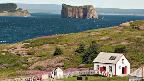
The Bonaventure Island overlooking the Perce rock Wednesday, July 25, 2012. THE CANADIAN PRESS/Jacques Boissinot
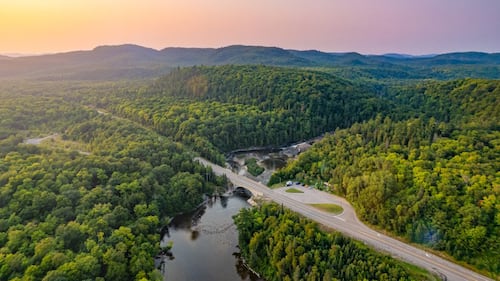
Distance: 700 kilometres
This scenic route from Sault Ste. Marie to Thunder Bay is also known as TransCanada Hwy 17 also features rugged shorelines along Lake Superior, the world’s largest freshwater lake.
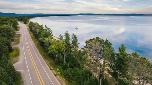
Stops along the way can include Haviland Bay, Chippewa Falls, Batchawana Bay Provincial Park, Pancake Bay, Aguasabon Falls & Gorge, the Terry Fox monument, and the famous Sleeping Giant cliffs.
Highway 17 at Batchewana Bay on the Lake Superior Coastal Trail. (Sault Tourism)
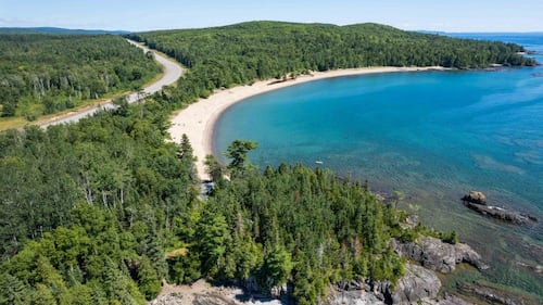
Sawpit Bay along the Lake Superior Coastal Trail. (Sault Tourism)
Distance: 540 kilometres
Manitoba is home to more than 100,000 lakes, with the Interlake Region located between the province’s two biggest lakes - Lake Manitoba and Lake Winnipeg - where travellers can stop at beaches, rocky cliffs and historical sites.
(Lake Winnipeg Foundation)

Starting in Winnipeg, the area features several quirky roadside attractions, the Hecla Lighthouse at Grindstone Provincial Park, Lundar Beach Provincial Park and Icelandic culture in Gimli.
(City of Winnipeg)

After travelling south from the Interlake Region to Selkirk, travellers can head back north to Fort Alexander and around Pinawa before heading east to Whiteshell Provincial Park to explore forests, lakes and ancient granite rock.
Whiteshell Provincial Park. (Explore the Whiteshell)
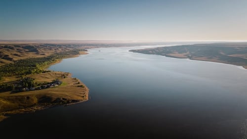
Distance: 320 kilometres
Circle Saskatchewan’s Lake Diefenbaker, the largest lake in Southwest Saskatchewan, from Saskatoon to Swift Current.
(Lake Diefenbaker Tourism / Facebook)
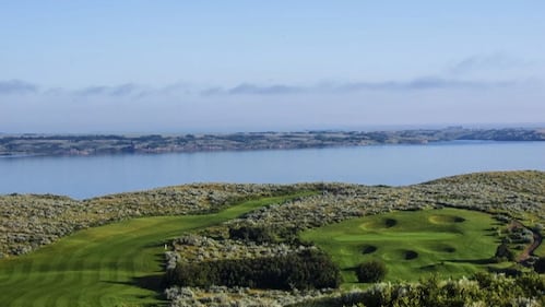
The manmade lake has 800 kilometres of incredible shoreline that offers full-service marinas, diverse wildlife, fishing and three provincial parks to explore, according to Tourism Saskatchewan.
(Tourism Saskatchewan)
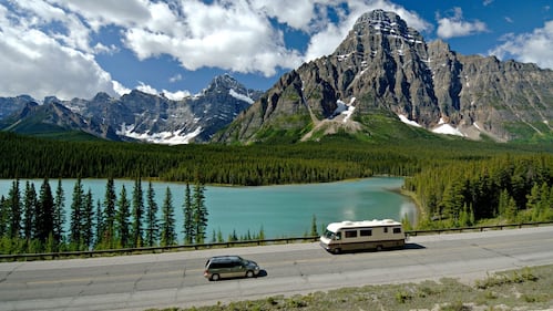
Distance: 232 kilometres
This spectacular drive through the Canadian Rockies begins at Lake Louise and ends in Jasper, Alberta.
Alberta's Icefields Parkway is seen in this undated image.
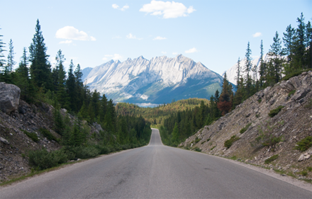
Also known as Highway 93 North, this route passes takes travellers through Banff National Park and Jasper National Park.
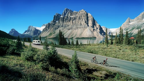
Other attractions on this route include Lake Louise Village, Bow, Crowfoot and Athabasca glaciers, the Columbia Icefield Discovery Centre, and Sunwapta Falls.
(icefieldsparkway.com)
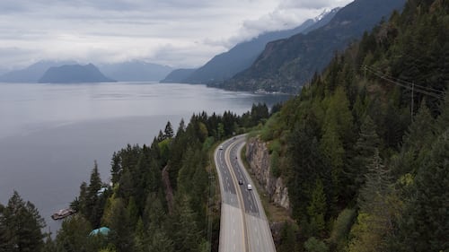
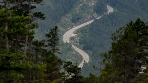
Distance: 137 kilometres
This spectacular mountain highway, also known as Highway 99, begins in Vancouver and end near Whistler in Pemberton, B.C., and is a busy destination in the summer months.
Motorists travel on the Sea-to-Sky highway between Horseshoe Bay and Lions Bay, B.C., on Friday, April 23, 2021. THE CANADIAN PRESS/Darryl Dyck
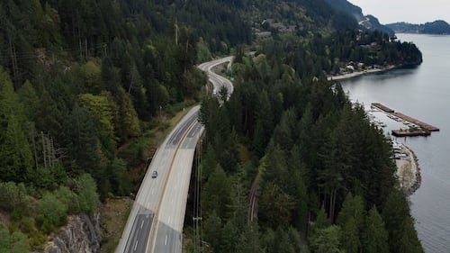
The route passes through iconic destinations such as Horseshoe Bay, Squamish and Whistler, B.C., and several provincial parks including Porteau Cove, Garibaldi and Brandywine Falls.
Motorists travel on the Sea-to-Sky highway between Horseshoe Bay and Lions Bay, B.C., on Friday, April 23, 2021. THE CANADIAN PRESS/Darryl Dyck
Other attractions on the route include the Capilano Suspension Bridge, Grouse Grind, Sea to Sky Gondola, Shannon Falls and Britannia Beach.
Motorists travel on the Sea-to-Sky highway in Squamish, B.C., on Thursday, June 26, 2025. THE CANADIAN PRESS/Darryl Dyck
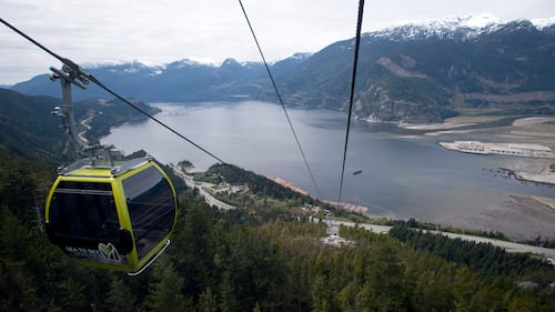
The waters of Howe Sound are seen in the background from the top of the Sea to Sky Gondola in Squamish, B.C., on Sunday, April 29, 2014. THE CANADIAN PRESS/Jonathan Hayward
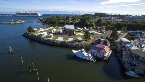
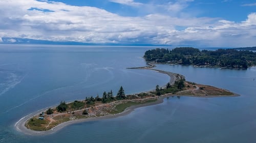
Distance: 289 kilometres
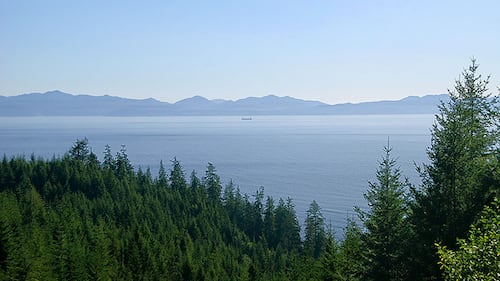
This route starting in Victoria, B.C. circles the southern part of Vancouver Island, with stops in Sooke, Cowichan Bay and Port Renfrew, and offers a mix of views from ocean to forests.
(Travel British Columbia)
Travellers will “wind through temperate rainforest, along rugged coastline, past totem poles, vineyards and lush farmland”, according to Tourism Victoria.
(Travel British Columbia)
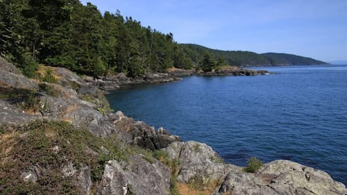
Travellers can also spend time at the East Sooke Sasquatch statue, Goldstream Provincial Park, Lake Cowichan and the Malahat Skywalk.
(Travel British Columbia)
(vancouverisland.com)
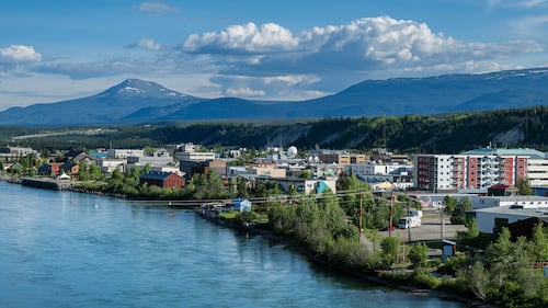
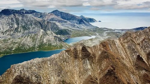
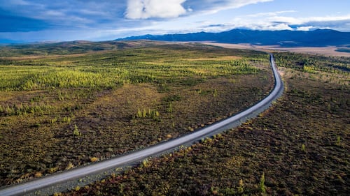
Distance: 715 kilometres
This northern highway, also known as ‘The Top of the World Highway’ begins in Skagway, Alaska and reaches Whitehorse and Dawson City, Yukon through British Columbia.
The Yukon River and downtown Whitehorse, Yukon, on Monday, June 24, 2024. THE CANADIAN PRESS/Mike Thomas
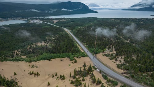
The highway is open year-round and takes travellers through remnants of the late 1800s Gold Rush, and passes communities such as Carcross and Tagish.
Motorists travel on the Klondike Highway past the Carcross Dunes in Carcross, Yukon, on Friday, July 25, 2025. THE CANADIAN PRESS/Darryl Dyck
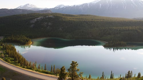
The sand dunes at Carcross Desert, also known as the world’s smallest desert, were formed when a glacial lake dried up after the most recent Ice Age. Other sites include Emerald Lake , Kookatsoon Lake and Five Finger Rapids.
(Yukon Info)
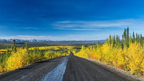
Distance: 926 kilometres
The Dempster Highway begins in Dawson City, Yukon and reaches Inuvik, Northwest Territories. In Inuvik, you can connect to the Inuvik-Tuktoyaktuk highway, the year-round road to the Arctic Ocean.
(Northwest Territories Tourism)
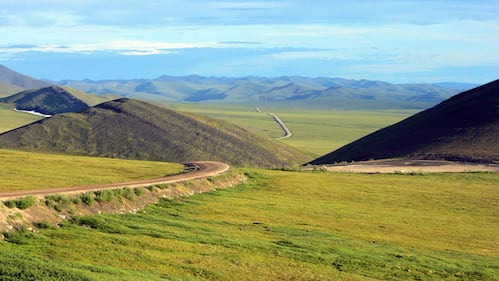
This remote route passes through the Arctic Circle, crosses the Mackenzie, Canada’s largest river basin, and onto the tundra.
(Northwest Territories Tourism)
Notable sites along the route include Tombstone Territorial Park in Yukon, the Arctic Circle monument, glaciers, Nataiinlaii Territorial Park and Gwich’in Territorial Park in N.W.T., and the Arctic Ocean in Tuktoyaktuk.
(Northwest Territories Tourism)
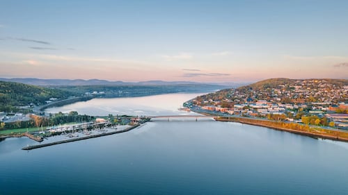
Distance: 7,500 kilometres
The Trans-Canada Highway is Canada's longest national road and extends east-west between St. John's, Newfoundland and Labrador and Victoria, British Columbia, and links major Canadian cities
Traffic is diverted as the Trans Canada Highway remains closed outside of St. John's N.L. due to a wildfire in the Paddy's Pond area on Wednesday, August 13, 2025. THE CANADIAN PRESS/Paul Daly
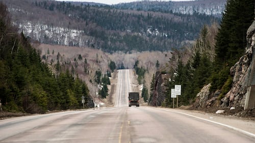
The Trans-Canada Highway consists of several different routes that cross Canada, including the Confederation Bridge to Prince Edward Island, two routes that begin in Montreal, and few through Ontario, according to Transport Canada.
A view of the Trans-Canada Highway from Sault Ste Marie to Wawa is shown on April 4, 2017. THE CANADIAN PRESS/Nathan Denette
The highway travels through Winnipeg, Regina, Calgary and Banff, and takes the scenic Kicking Horse Pass through the Canadian Rockies. It continues through Kamloops to Vancouver Island in British Columbia.
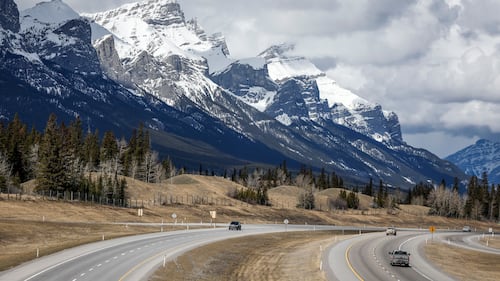
Traffic travels along the Trans Canada Highway past Mount Rundle of the Rocky Mountains near Canmore, Alta., Monday, April 24, 2023.THE CANADIAN PRESS/Jeff McIntosh