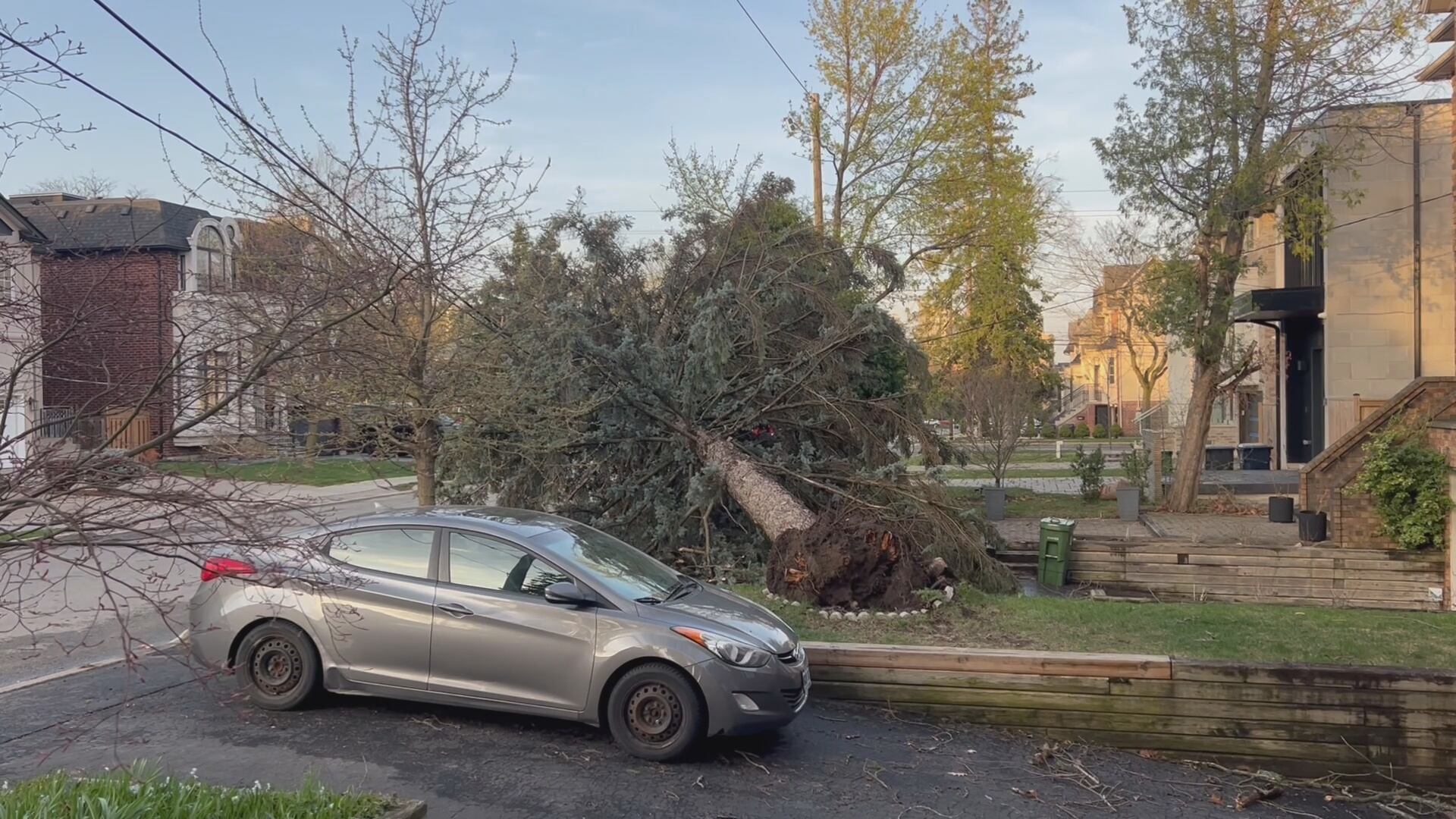
Thousands of Torontonians are without power due to “high winds and storm activity,” as strong southwesterly winds continue to blow through the city.
Environment Canada had issued a thunderstorm warning for the city but that has since lifted. A special weather statement remains as up to 80 km/h are forecast for the evening.
“Crews are also responding to multiple reports of wires down,” a Toronto Hydro spokesperson told CTV News Toronto, noting restoration times vary depending on the area.
Based on their outage map, some homes won’t see their power turn back on until Wednesday morning.
“Loose objects may be tossed by the wind and cause injury or damage. More utility outages may occur,” Environment Canada said in the weather statement. “Motorists, especially in high profile vehicles, may expect hazardous driving conditions on highways subject to strong crosswinds.”
The rain started falling just an hour before the Toronto Maple Leafs take on the Ottawa Senators in Game 5 of the Stanley Cup playoffs.
Scotiabank Arena initially advised fans attending the tailgate to vacate the area due to the inclement weather, but have since reopened the space after the rainfall paused.
The Tailgate at Maple Leaf Square has now reopened. Tailgate pass holders are invited to queue at the entrance gate. We thank you for your patience. pic.twitter.com/XFBgzsQ6iS
— Scotiabank Arena (@ScotiabankArena) April 29, 2025
Earlier in the day, emergency crews were called to the area of St. Clair Avenue and Avenue Road after a tree branch fell on a woman, leaving her with critical injuries. Police say early reports indicate that the high winds may have been a factor.
What can you do to prepare for major thunderstorms?
Some of these thunderstorms produce strong wind gusts that can pick up loose objects and cause them to become dangerous projectiles that can cause significant damage to buildings, experts warn.
So, the first order of business should be to secure any lawn furniture or loose objects on your property or move them indoors to keep them from flying around.
Severe thunderstorm watches are issued a few hours before the storm rolls in, so experts advise keeping a weather app handy so you can keep an eye out for any alerts in your area.
When is the thunderstorm expected to end?
Experts say the “worst of the storm activity” is expected to move down into New York after around 9 p.m.
Cooler air will flood into the region in the wake of the cold front that will drive the late afternoon storms, according to Coulter.
“The temperature will drop from 25 C Tuesday afternoon to just 2 C by Wednesday morning,” he says.
Thursday and Friday could see the return of some showers, going into Saturday morning. However, Sunday is expected to be mainly sunny.


